No products in the cart.
Inuit Cartography
Inuit Cartography
Text and photo: www.decolonialatlas.wordpress.com
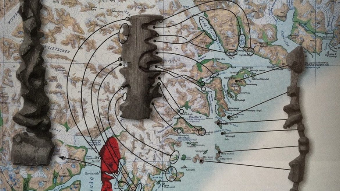
In Kalaallit Nunaat (Greenland), the Inuit people are known for carving portable maps out of driftwood to be used while navigating coastal waters. These pieces, which are small enough to be carried in a mitten, represent coastlines in a continuous line, up one side of the wood and down the other. The maps are compact, buoyant, and can be read in the dark.
These three wooden maps show the journey from Sermiligaaq to Kangertittivatsiaq, on Greenland’s East Coast. The map to the right shows the islands along the coast, while the map in the middle shows the mainland and is read from one side of the block around to the other. The map to the left shows the peninsula between the Sermiligaaq and Kangertivartikajik fjords.
Source: Topografisk Atlas Grønland